Sharing Data Public datasets available for coronavirus analysis in San Diego County, California, or U.S.
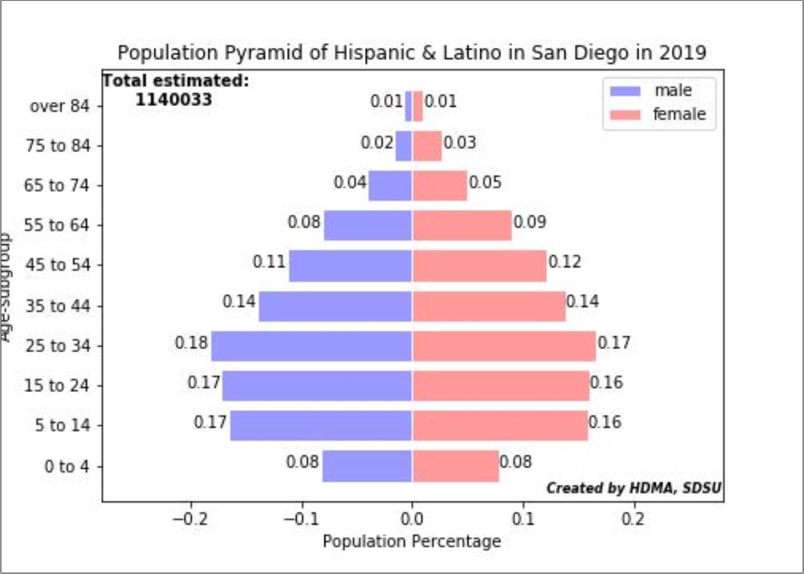
San Diego Population Pyramid
Datasets about the population percentage of different races in San Diego in 2019. Zip file contains the different data sets, including African American, Asian, American Indian, Hawaiian and Pacific Islander, Hispanic and Latino, White, and Two or More races. The pdf file contains visualizations created by the HDMA center using the datasets.
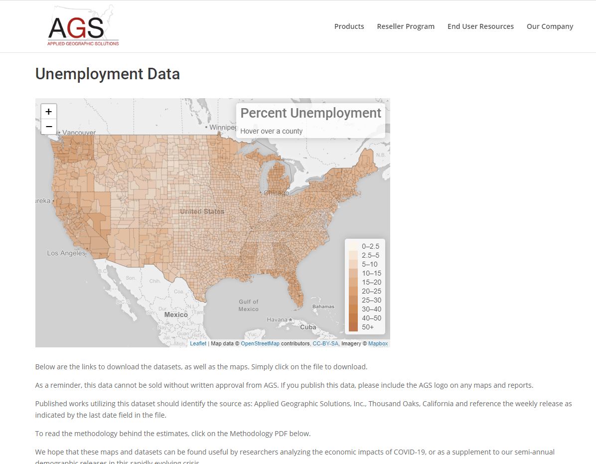
San Diego and U.S. Unemployment Data by AGS
Datasets include GIS data for the U.S. regarding unemployment rate at multiple levels: U.S., State, County, and Zipcode. Datasets are updated weekly. Data sourced from Applied Geographic Solutions, Inc. (AGS).
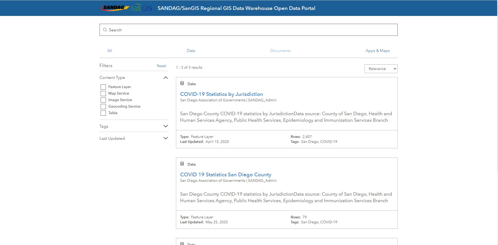
COVID-19 Data Sharing by SANDAG and SanGIS
Warehouse includes data sets for San Diego County related to COVID-19. Data sourced from the County of San Diego, Health and Human Services Agency, Public Health Services, Epidemiology and Immunization Services Branch and published by the San Diego Association of Governments (SANDAG).
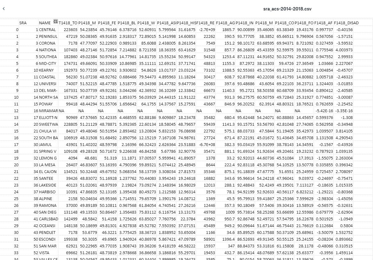
2014-2018 ACS Data at the SRA and ZipCode Level
Dataset includes census GIS data for San Diego County for 2014 and 2018 in CSV files and R-shapefile formats. Data compiled by Dr. Joseph Gibbons (Sociology, SDSU).
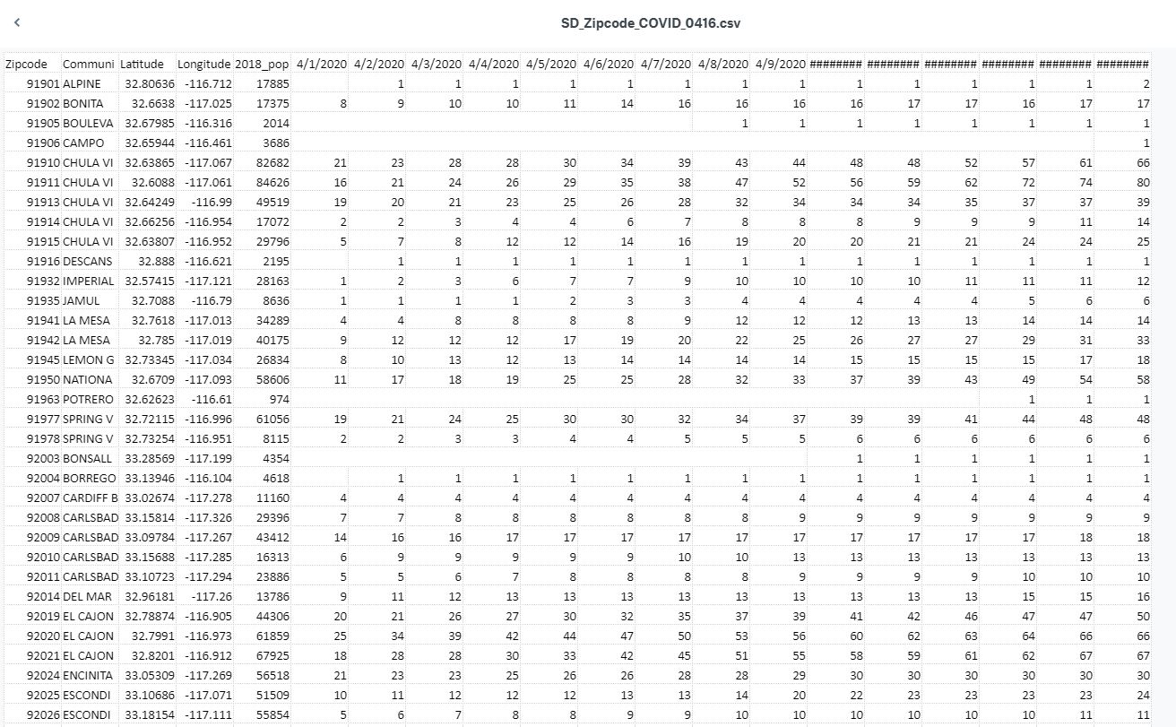
Historical Confirmed Cases in San Diego at the Zip Code level
Dataset updated daily for historical confirmed cases in San Diego at the zip code level.
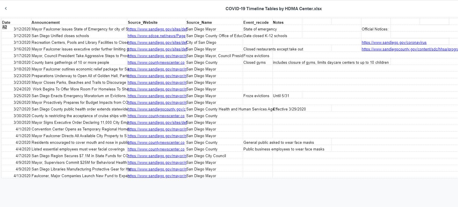
Timeline Tables
COVID-19 timeline tables for 16 major U.S. cities and California. Includes: Dallas, New York City, Los Angeles, Chicago, Houston, Washington D.C., Boston, Denver, Detroit, Seattle, Las Vegas, San Francisco, Minneapolis, Miami, Phoenix, San Diego, California, US, and Global.