Map Hub for San Diego A collection of the regularly updated maps regarding San Diego County.
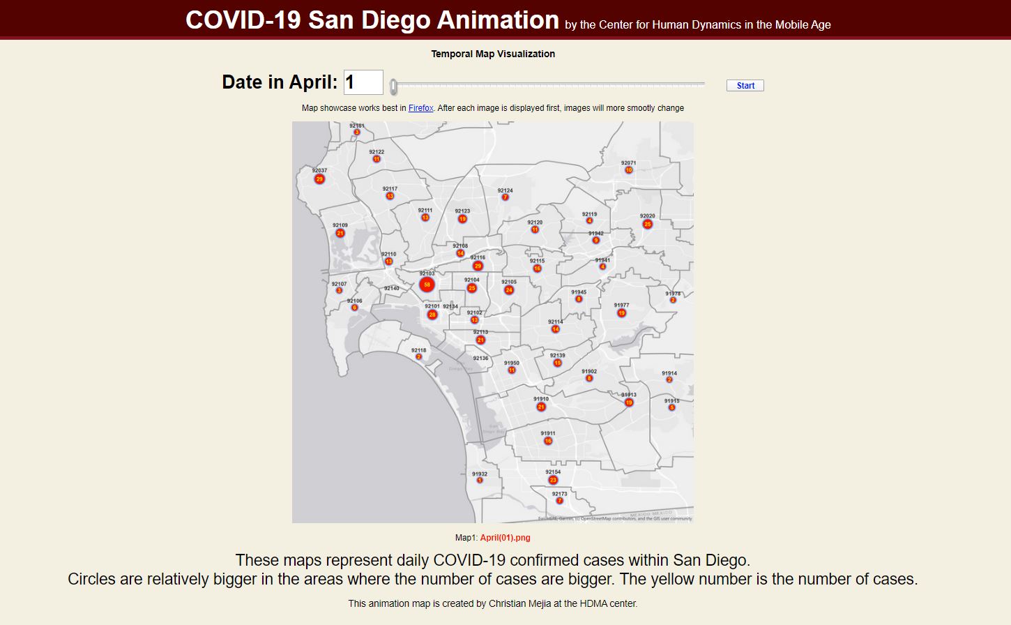
Animated Zip Code Maps
These animated maps illustrate the change of Zip Code level confirmed cases in Southern San Diego by Month starting April 01, 2020 onward. The significant increased case in South Bay is a major concern. These maps were created by Christian Mejia at the HDMA Center.
Animated Zip Code Map (April 2020) →
Animated Zip Code Map (May 2020) →
Animated Zip Code Map (June 2020) →
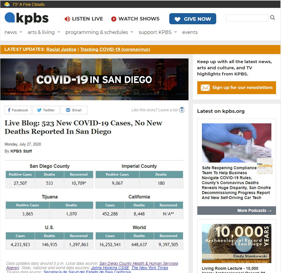
KPBS San Diego COVID-19 News Blog
KPBS live news blog reporting news updates regarding COVID-19 in San Diego.
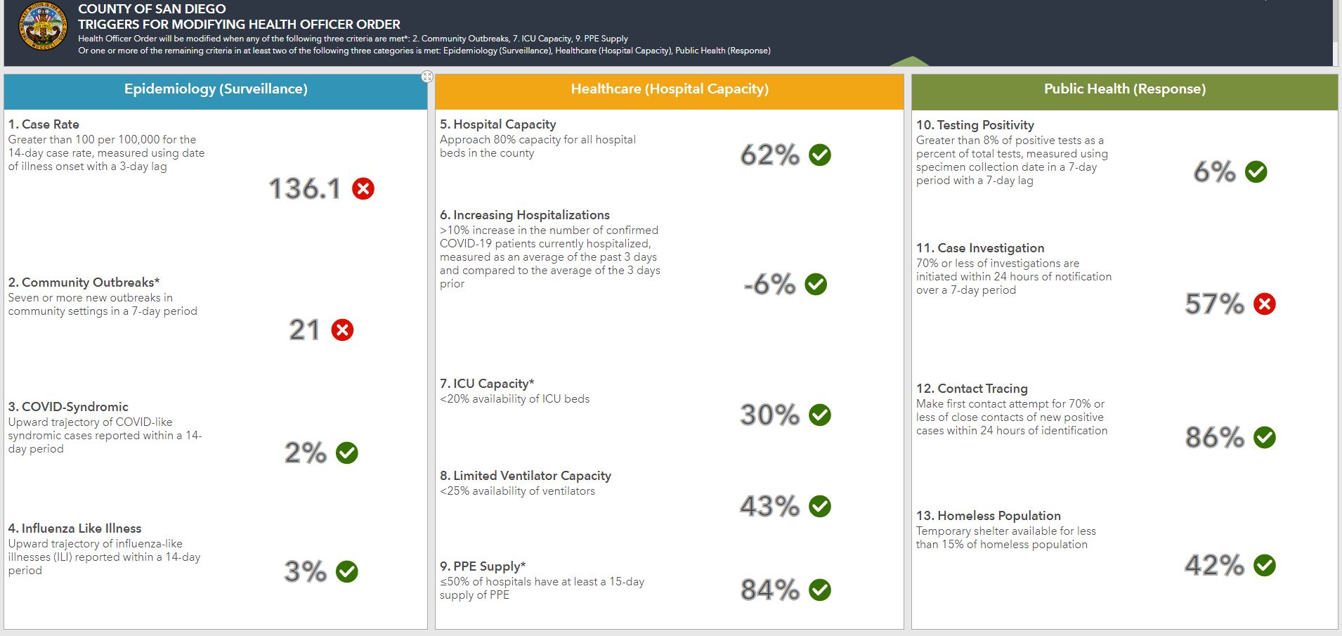
County of San Diego: Triggers for Modifying Health Officer Order
The County of San Diego dashboard lists the criteria required to modify the Health Officer Order, as well as the current related numbers and rates.
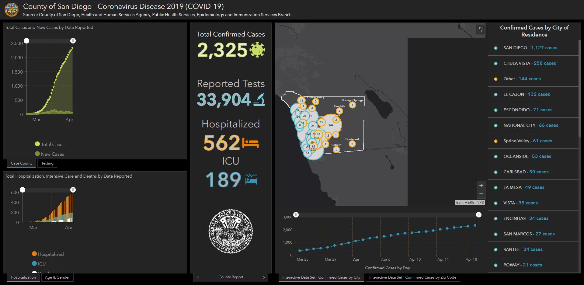
County of San Diego: Coronavirus Disease Dashboard
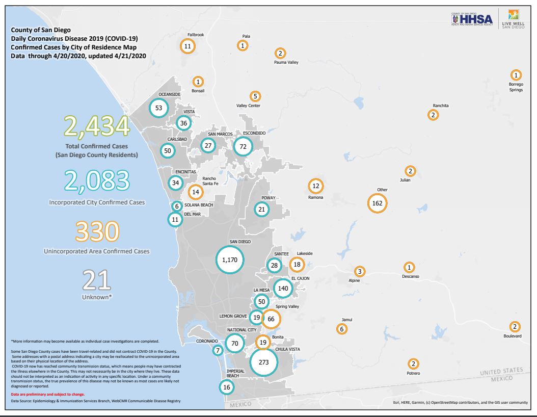
County of San Diego: Confirmed Cases by City of Residence Map
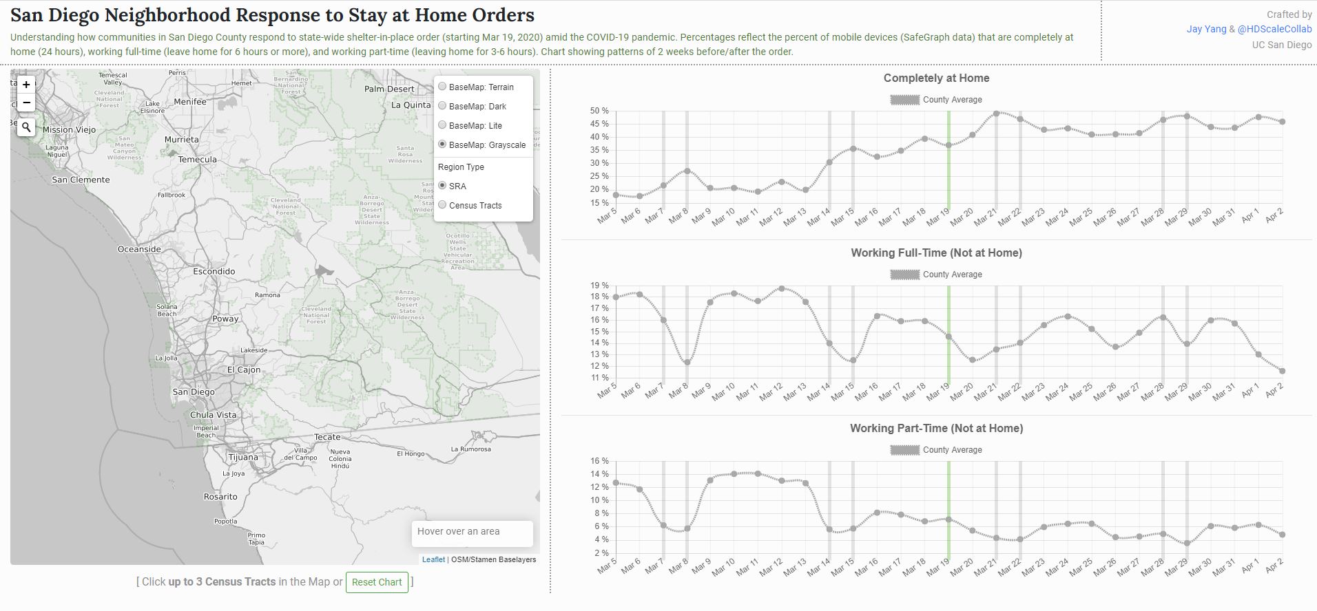
San Diego Neighborhood Response to Stay at Home Orders
Created by Jiue-An Yang
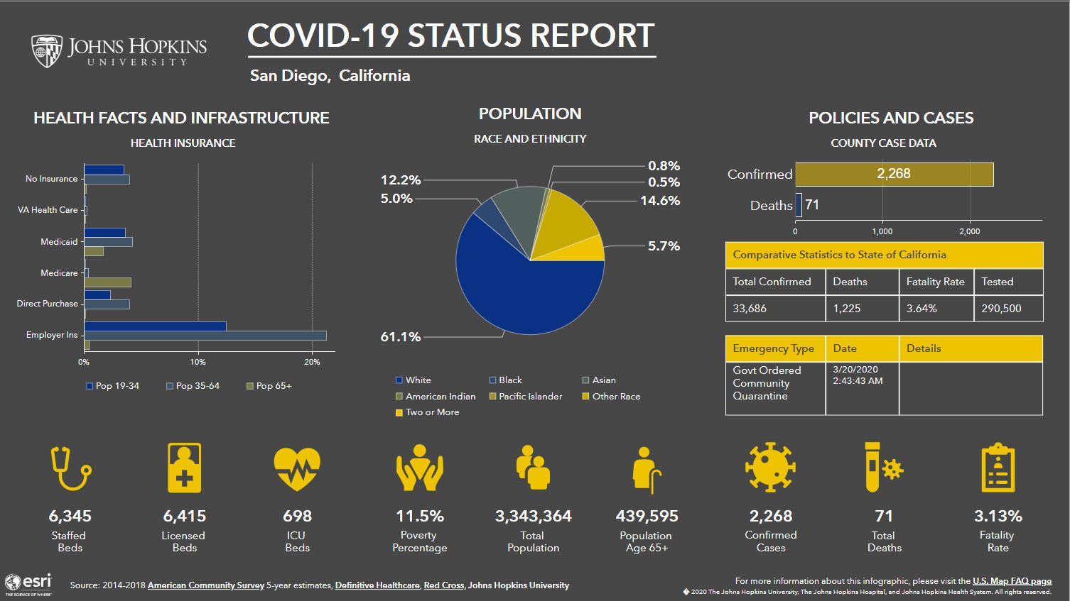
Johns Hopkins University Healthcare Analytics Dashboard
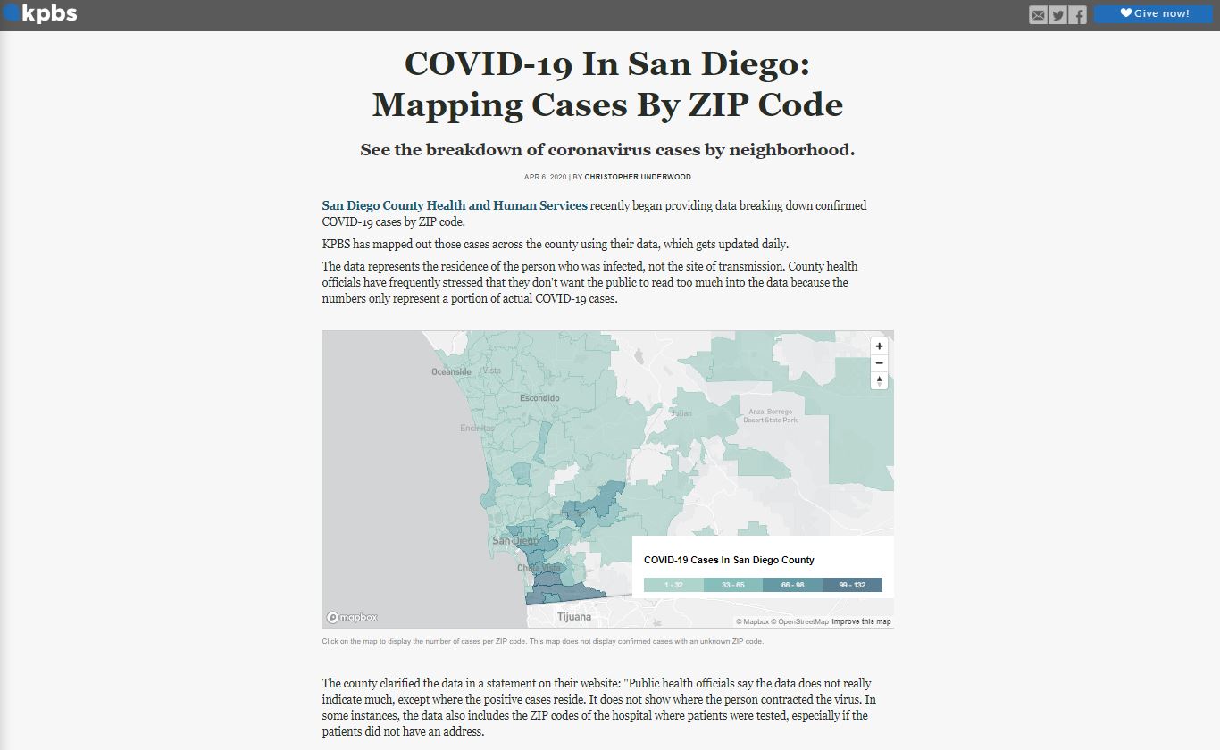
KPBS COVID-19 Mapping
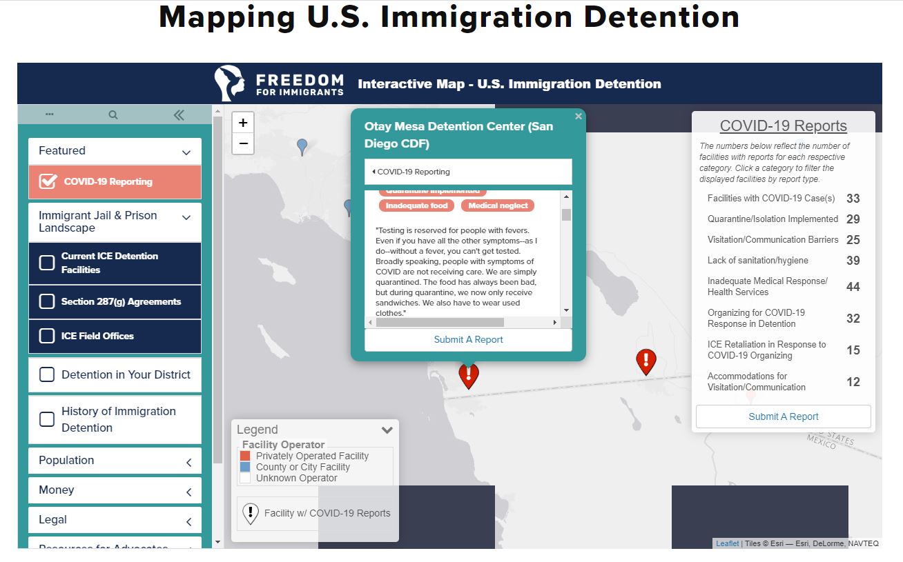
Immigration Detention Map with COVID-19 Reports
Otay Mesa Detention Center